-
-


-
Wall Color
in
Uncheck to hide the white line Check to show the white line -
-
.


Frame
Room
Gallery
Historic Map : Lloyd's official Map of The State of Kentucky, 1863 v2
Historic Map : Lloyd's official Map of The State of Kentucky, 1863 v2
Note: Sold out or unavailable
Couldn't load pickup availability
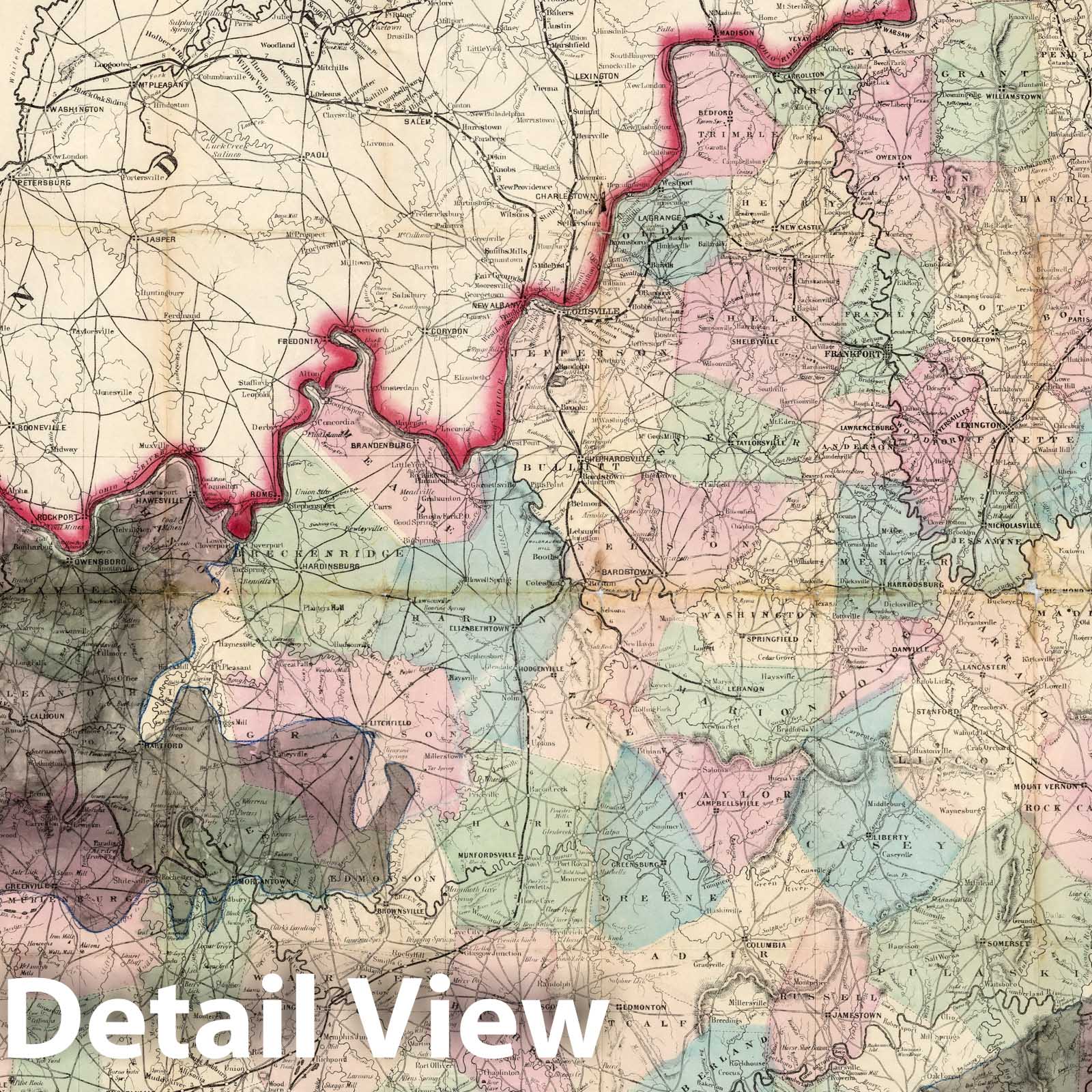
Lloyd's Official Map Of The State Of Kentucky Compiled from Actual Surveys and Official Documents, Showing Every Rail Road & Rail Road Station with the distances between each station ... 1863. New York, J.T. Lloyd, Publisher, 164 Broadway. Entered ... 1862 by J.T. Lloyd... New York. | Lloyd's Official Map Of The State Of Kentucky Compiled from Actual Surveys and Official Documents, Showing Every Rail Road & Rail Road Station with the distances between each station ... 1863. New York, J.T. Lloyd, Publisher, 164 Broadway. Entered ... 1862 by J.T. Lloyd... New York. | This is the same as our other copy except that the extensive coal fields in Eastern and Western Kentucky have been manuscript colored in gray wash, carefully delineated. David Owen published maps showing the Kentucky coal fields in 1852 and 1853 and they may have been the source of the information. The Kentucky coal fields were considered a strategic asset by the North in the Civil War. Coal mining in these areas began in earnest in the 1870's with the expansion of the railroads. This copy is folded into plain dark brown cloth covers 15x10, without the Colton imprint found in our other copy. Full color by county.
We print high quality reproductions of historical maps, photographs, prints, etc. Because of their historical nature, some of these images may show signs of wear and tear - small rips, stains, creases, etc. We believe that in many cases this contributes to the historical character of the item.
- MUSEUM QUALITY INKS AND PAPER: Printed on thick 192gsm heavyweight matte paper with archival giclee inks, this historic fine art will decorate your wall for years to come.
- VINTAGE MAP REPRODUCTION: Add style to any room's decor with this beautiful print. Whether your interior design is modern or classic, a map is never out of fashion.
- ATTENTION TO DETAIL: We edit every antique map for image quality, color and vibrance, so it can look its best while retaining historical character. Makes a great gift!
- FRAME READY: Your unframed poster will arrive crease-free, rolled in a sturdy mailing tube. Many maps fit easy-to-find standard size frames 16x20, 16x24, 18x24, 24x30, 24x36, saving on custom framing.
- Watermarks will not appear in the printed picture. Some blemishes, tears, or stamps may be removed from the final print.
Why choose Historic Pictoric
Every artwork we offer is carefully edited by our small but dedicated team of image professionals, ensuring each detail is perfect. We print every order to demand right here in the USA, treating every piece with the same care and attention we would give our own work. From editing to printing to packaging, we take pride in delivering artwork that meets our high standards—and we love knowing it’s heading to a home where it will be appreciated.